The St. Olavsleden is the easiest of all Via Gaia cycling routes. The first 400 kilometres to the Norwegian border climb gradually to an altitude of 650 metres. After that, there is more climbing and descending. Over a distance of 165 kilometres, you descend from 650 metres to sea level, with regular short and sometimes challenging climbs in between.
There are more than 150 accommodations affiliated with the St. Olavsleden. These accommodations range from very basic to luxurious. And also if you enjoy wild camping, this is a great route. There are countless places to stay, including shelters and lakes where you can also swim.
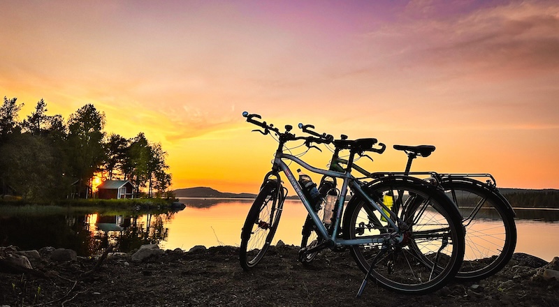
Photo: Gerrit Vink
All practical information at a glance:
Guide
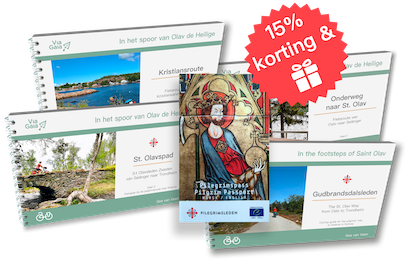
The guide is for sale in the Via Gaia Webshop, and contains:
- route segmentation per region;
- maps with the bicycle route and the alternative routes;
- elevation profile per segment;
- a global route description;
- information on how hard it is and road surface quality;
- information in attractions and highlights;
- mentions of accommodations, shops and places to eat;
- information to arrange your trip to your preferences;
- Information about transportation;
GPX tracks
The tracks can be found through the QR code in the guide.
The total length of the main route is 565 kilometres. This will take you about ten days to complete.
Route layout:
- Stage 0 – Proloog
From Sundsvall to Selånger (7 km) - Stage 1 – Medelpad
From Selånger to Bräcke (125 km) - Stage 2 – Jämtland Oost
From Bräcke to Östersund (87 km) - Stage 3 – Jämtland West
From Östersund to Duved (126 km) - Stage 4 – Grensgebied
From Duved to Stiklestad (97 km) - Stage 5 – Trøndelag
From Stiklestad to Trondheim (123 km)
Elevation profile
Click or tap to enlarge

Elevation
Actually, I'm not a fan of displaying the total of ascent and descent in metres. In my view these are just 'numbers' used for indication and can differ in the real world. Depending on the source or app, the elevation can differentiate up to 10%.
For those who still like numbers, there's an overview of numbers in the guide at the beginning of each stage. The source is judise.nl, a gpx-route editor who's elevation numbers in Scandinavia are comparable to the popular Strava (for The Netherlands, Belgium and Nord-Rhein Westfalen the numbers of Judise are even more precise). Maybe your route app shows different altitude meters than here for the Gudbrandsdalsleden. The truth is probably somewhere in the middle or above or... and this is exactly the reason that I don't attach much importance to the numbers myself...
Stage 1, Medelpad
Ascent: 1252 m, descent: 979 m.
Average gradient: 1,8 %
Stage 2, Jämtland Oost
Ascent: 596 m, descent: 594 m
Average gradient: 1,4%
Stage 3, Jämtland West
Ascent: 1364 m, descent: 1268 m
Average gradient: 2,1%
Stage 4, Grensgebied
Ascent: 703 m, descent: 1075 m
Average gradient: 1,8%
Stage 5, Trøndelag
Ascent: 1540 m, descent: 1546 m
Average gradient: 2,5%
And now for a personal note: from experience I know that numbers are not very relevant. In context, over a distance of 600 km a couple of hundred elevation meters are not that useful. What matters most are the percentages in elevation. A kilometre climbing with 3% is different from a kilometre climbing with 18%. Even more relevant is the fact that one day can be better that the next depending on the mood. health, weather... In short, there are many factors that can make the experience of a trip difficult or easy. No number can account for that.
The road conditions for the cycling route are reasonable to good. The larger the roads, the better the conditions. You cycle on paved roads as well as on gravel roads. The unpaved roads are generally passable, with a few difficult sections here and there.
Compared to the popular route to Santiago de Compostela, the St. Olavspad is very quiet. While around 300,000 people make the pilgrimage to Santiago every year since 2010, only around 1,000 make the journey to Nidaros. Most of them start from Oslo. On the Swedish route, there are a few hundred people per year. You will certainly meet others along the way, but you may also go for days without encountering another pilgrim. The route is most commonly walked and cycled by Germans, Swedes, Norwegians and Dutch people. Other Europeans and non-Europeans are also discovering the trail, but so far in smaller numbers.
To celebrate the feast day of St. Olav (July 29), the Olavsfestdagene festival is held in Trondheim each year, with many art, music, and church related activities. Not only is it the largest festival in Norway, it is also the time of the year when pilgrims plan to arrive. Groups of pilgrims often arrive on organized trips, so booking accommodation in this period may be more difficult for the individual pilgrim.
 In addition to the inland route, there is also a marked coastal route for the final stretch between Munkeby and Trondheim. This so-called outer path (yttre leden) is approximately 55 kilometres long and takes you via the beautiful Frosta peninsula to the monastery island of Tautra with its beautifully situated Cistercian nunnery. Not only is this route to Trondheim much shorter, but it also involves less climbing. The disadvantage is that you are dependent on a boat crossing that does not run every day and must be booked in advance. This route is marked on the map at the back of the guide, but is not described separately in the guide.
From 2026, there will be a new boat for pilgrims to cross. At the time of publication of the guide, it was not yet known whether bicycles would be allowed on board. If it turns out that bicycles are allowed, this article will be expanded with downloadable maps, a GPX track and route description.
Photo: Øyvind Wold
 Page 100 of the guide refers to an “old” cycle route. Here you can read about this Malvik route and download the map and GPX file.
At the church in Lånke, you can choose between the new and the old route. Since 2025, the new pilgrimage route for both walkers and cyclists has followed a comfortable, flat cycle path along the beautiful Trondheim Fjord. The old cycle route is still available and signposted, but is a lot more challenging and adventurous. This route, which mainly consists of forest paths with quite a few climbs, is therefore more suitable for bike packers. If you want to cycle this route, turn left at the church.
Map & GPX
Download the  PDF of the map here.
Dowload the GPX of the route here.
Route description
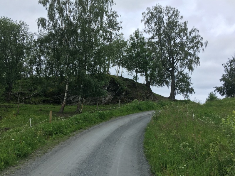
At Lånke, turn left onto Dyvasvegen and head south. This is a beautiful winding road through farmland. You will climb steadily for over 6 kilometres until you reach the main road. Cross this diagonally to the right. This gravel road climbs steeply into the forest for the first 2 kilometres. The next few kilometres are fairly flat and you will arrive at an idyllic spot by the lake with two shelters. A little further on, make a sharp right turn and follow the Navra river valley downhill to where it meets the Homla river and continue cycling on a paved road to Bakken. Here, turn left towards Jonsvannet
⇒ Would you like to see the Storfossen waterfall? Then turn right 400 metres before you reach Bakken, onto Nygårdsvollvegen. After 1.7 kilometres, you will arrive at a viewpoint where you can enjoy a good view of the impressive waterfall.
You climb 3 km along an unpaved path. Then there is a forest path to the right, the Honstadvegen. You pass the barrier and climb a little further before you can start a long descent. This forest path runs past beautiful little mountain lakes and ends at a paved road. Continue cycling north on the Markabygdvegen. Further on, hikers will also arrive at this road. If you want to visit the Fjølstadtrøa museum, turn right there, towards Flølstadtrøa. After 350 m, the museum will be on your left.
Fjølstadtrøa museum
A Husmannsplass was a small tenant farm on the land of a gentleman farmer. Until well into the nineteenth century, gentleman farmers ruled their land like monarchs. Farmhands and maids had to ask permission to marry, and the gentleman farmer sometimes took the right to “initiate” the bride himself. Only the firstborn son inherited the farm. Other sons could become servants or seek their fortune elsewhere. One option was to work on a small farm in an unfavourable location on the gentleman farmer's land, known as a husmannsplass. Other poor farmers could also lease such a husmannsplass. They paid the rent with extra work for the farmer or in cash. With the mechanisation of agriculture, many tenant farmers bought themselves out and the great social inequality diminished
You continue cycling along Markabygdvegen towards the E6, the main road that runs the entire length of Norway. You can let your eyes wander along the horizon. You pass the E6 via a pedestrian tunnel and continue on the other side. You climb a little further and arrive at a milestone with the text “12 km til Nidaros”, next to which is a path through the forest to Saksvikkorsen. Along the medieval pilgrimage routes, crosses were often placed at prominent points. Above the Saksviksgarden farm, on the highest slope, there was such a special cross. Here, pilgrims took a moment to rest, knelt down and thanked God for their safe passage. From this point, they saw the spires of their final destination for the first time: the imposing Nidaros Cathedral. This is how the name Saksvikkorsen, the Saksvik Cross, came about. The original cross has disappeared, but a new wooden cross was erected in 2009. At the same time, the forest was thinned out, revealing the panoramic view of the city once again. Today, Saksvikkorsen is an idyllic spot for a short break with a panoramic view. To get here, follow the 75-metre-long forest path.
Cycle a little further downhill and you will arrive at the small tunnel under Malvikvegen. This is also where the coastal cycle route ends.


 A complete address list with all the necessary information can be found via the interactive map and a PDF on the S:t Olavsleden website:Accommodations S:t Olavsleden
Many of the accommodations offer meals and other services, such as Wi-Fi and laundry facilities. This is indicated in the description for the accommodation in question. Below the interactive map, you will find a download link for the PDF.
Informatie over wildkamperen en over shelters vind je bij het volgende tabblad Wild camping.
There is ample accommodation available along this route. The available accommodation ranges from very basic to luxurious. Even if you don't bring a tent, you will need a sleeping bag. In many accommodations, it is cheaper if you don't use bed linen, and sometimes there is no bed linen available at all. The guide lists the accommodations that are affiliated with the St. Olavspad. More overnight stays can be found through services such as Airbnb, Booking.com and various camping websites.
Photo: Nicky Vuersteak
Camping or staying overnight?
Cycling with a tent has its specific advantages in Scandinavia. There are many campsites along the route, and you can also choose to camp in the wild. You will come across supermarkets every day along the way. If you cycle with a tent, you can decide your own stages and budget.
If you stay in a B&B or cabin every night, you will be cycling much lighter, although you will still have to carry a sleeping bag or sheet bag. In many places, you are guaranteed dinner, breakfast and a packed lunch. The disadvantage is that you sometimes have no control over your diet (no choice at dinner), which can be difficult for vegetarians, for example.
Eating
Supermarkets can be found in almost all towns along the route. However, in the border area between Duved in Sweden and Vuku in Norway, there are no shops for a distance of 90 kilometres. Most towns have places to eat. In Sweden, you can usually also go to a café for a fika.vhembygsgård.
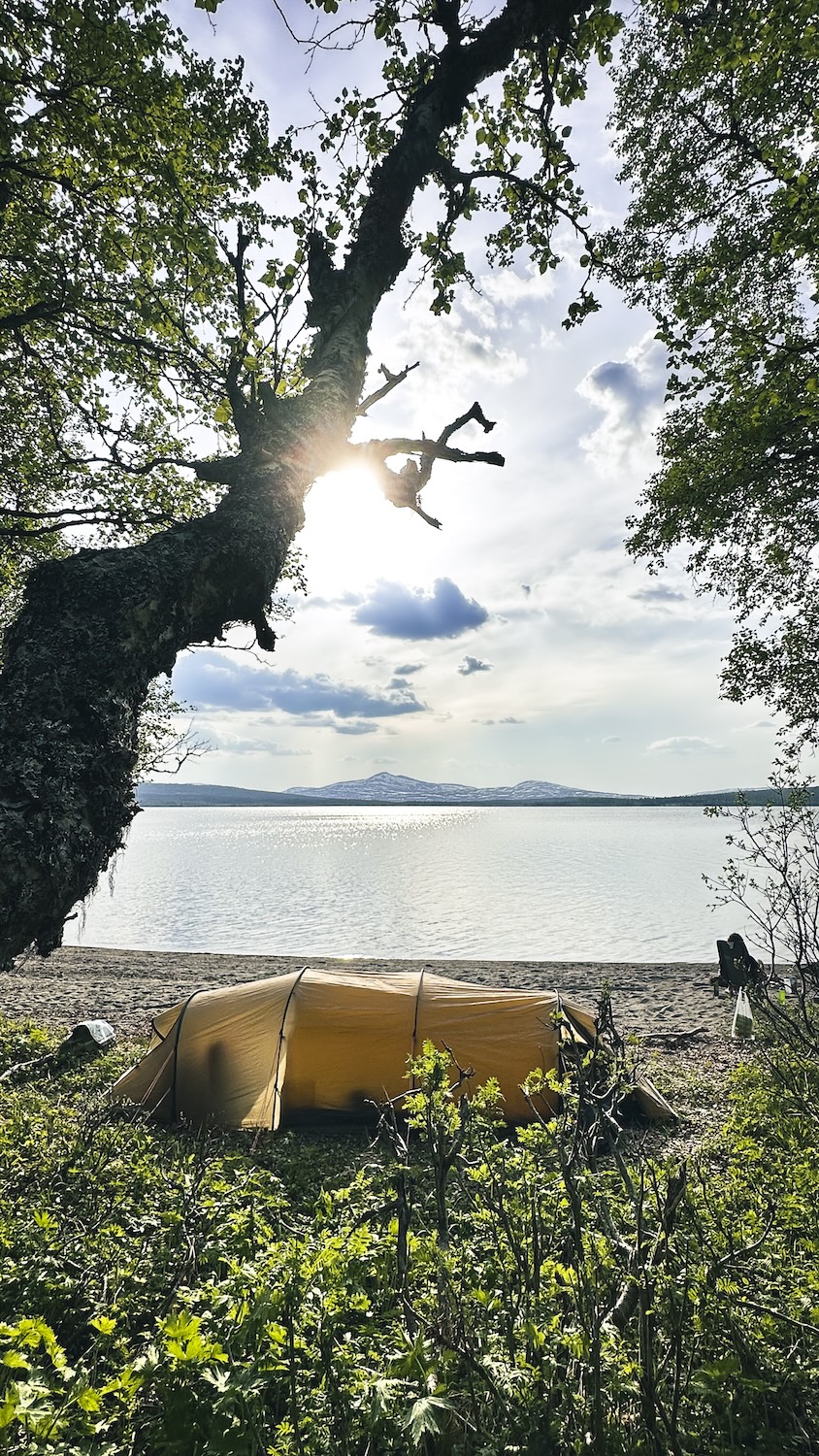 Wild camping is permitted almost everywhere in nature (everyman's right), provided you keep at least 150 metres away from houses and fences. On farmland, you must ask the farmer for permission. Suitable spots can be found along the entire route. The maps in the guide also indicate shelters (vindskydd in Swedish and gapahuk in Norwegian). Depending on your own standards, these shelters are often suitable for spending the night. More information about wild camping, the right of public access and a list of shelters can be found in the menu under Info & Tips.
Voor Noorwegen: Info & Tips → Noorwegen → Wildkamperen in Noorwegen
Voor Zweden: Info & Tips → Zweden → Wildekamperen in Zweden.
 A hembygdsgård is a Swedish term for a local history association or club. Often situated in a historical farm (gård). Many villages have such a small but cosy museum association or club that gathers and manages the local cultural heritage. Hembygdsgården is often used for celebrations like midsummer and Christmas, but also for weddings. In summer, there's always something to do. For cyclists, it is a perfect stop for a break. These spots are not only filled with cultural heritage, but they often serve fika, a cup of coffee with a range of homemade cake and cookies. This phenomenon is called a summer cafe. You can find such seasonal cafes on other places as well. In the - by volunteers run - hembygdsgård, the atmosphere is almost always easy-going. There are even a couple of them where you can pitch your tent for a night.
Along the route, you will find a number of pilgrim centres and service points for pilgrims. All of these centres can provide you with up-to-date route information and sell or stamp your pilgrim passport. Here you will find the addresses, email addresses and websites of the relevant centres.
Kulturmagasinet
Packhusgatan 4, 852 31 Sundsvall
T +46 60 19 18 00
E This email address is being protected from spambots. You need JavaScript enabled to view it.
Turistinformation and servicepoint for pilgrims.
Pilgrims centre Selånger
Kungsnäs 159, 855 91 Sundsvall
Opens around Easter 2026, by which time the contact details will also be known.
Starting point of the route.
Naturum Ånge / Borsjö pilgrimcenter
Borgsjöbyn 137, 841 97 Erikslund
T +46 690 25 04 50
E This email address is being protected from spambots. You need JavaScript enabled to view it.
Tourist information, exhibition, eatery and camping
Revsund Brewery & Distillery
Revsund 120, 94396 Gällö
T +46 69 31 20 20
E This email address is being protected from spambots. You need JavaScript enabled to view it.
Pilgrims centre, accommodation and eatery
Visit Östersund
Storgatan 27, 831 30 Östersund
T +46 637 01 17 00
E This email address is being protected from spambots. You need JavaScript enabled to view it.
Turistinformation and servicepoint for pilgrims.
Frösö Pilgrimscentrer
Stockevägen 17, 832 96 Frösön
T +46 761 07 67 81
E This email address is being protected from spambots. You need JavaScript enabled to view it.
Pilgrims centre, accommodation, eatery, exhibitions and museum shop.
Hållandsgården
Moänge 274, 837 94 Järpen
T +46 64 73 10 10
E This email address is being protected from spambots. You need JavaScript enabled to view it.
Servicepoint for pilgrims and accommodation.
Stiklestad Nasjonale Kultursenter / Pilegrimssenter Stiklestad
Stiklestad Alle 350, 7656 Verdal
T +47 74 40 17 16
E This email address is being protected from spambots. You need JavaScript enabled to view it.
Pilgrims centre, accommodation, eatery, exhibitions and museum shop.
Pilegrimssenter Nidaros Pilegrimsgård
Kjøpmannsgata 1, 7013 Trondheim
T +47 73 52 50 00
E This email address is being protected from spambots. You need JavaScript enabled to view it.
Pilgrims centre and accommodation
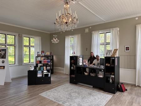
Pelgrimscentrum op het eiland Frösö
The St. Olavsleden can be combined with the cycling routes described below. Click or tap on the route name for more information on that route.
Routes 1, 3 and 4 are part of the series In the Trail of Olav the Saint, like the St. Olavsleden.
Naar of vanuit Sundsvall
- On the way to St. Olav. A cycling route from Oslo to Selånger where it connects to the St. Olavsleden.
- Sverigeleden. A whole cycle route network across Sweden. From Sundsvall, you can cycle north along the coast via the Sverigeleden.
Naar of vanuit Trondheim
- Gudbrandsdalsleden. A pilgrim route from Oslo to Trondheim.
- The Coastal pilgrim route. Also known by its Norwegian name, Kystpilegrimsleia. A pilgrim cycling route from Egersund to Trondheim.
- EuroVelo 1, also known as the Atlantic Coast Route. A cycling route along the entire European coast of the Atlantic Ocean, from Portugal to the North Cape.
Click to enlarge:

The guide provides information on how to get to Selånger or Trondheim and back again, see pages 110 and 111.
Here are the links to more information about the options mentioned, plus the booking sites:
By bike:
- Cycling route On the way to St. Olav. From Moss or Oslo, you cycle to Selånger, the starting point of the St. Olavsleden.
By bus:
From The Netherlands:
- With the Dutch company Fietsvervoer: Route 14 to Göteborg.
- With the Dutch company Cycletour: Fietsbus Göteborg.
From other countries: no information available.
By train:
- Entirely or partly by train: check the Dutch article: Info en tips → Zweden → Fiets in Zweedse bus of trein. That article discusses all possible options in detail. At the beginning of 2026, this article will also be translated into English and a link to it will be provided.
- Part of the train journey can be booked with Deutsche Bahn.
By ferry:
- (by train to Kiel in Germany) and from Kiel by ferry to Gothenburg(Stenaline).
Bus
In many cases, you can also take your bicycle on the bus along the entire route, provided there is space available. The driver will decide this.
Train
Parallel to the St. Olavspad, there is a train line to Duved that allows bicycles. From Duved, the St. Olavspad continues in a north-westerly direction and the train heads west to Storlien. In Storlien, you can transfer to a Norwegian train that takes you to Trondheim. You can buy a ticket online (at SJ.se) or on the train.
The SJ app is a useful tool. You can use it to purchase tickets and have them scanned during inspections. If you create a profile, you will also receive notifications of changes to your journey.
Download her the app in the Appstore or in Google Play.
On page 112 of the guide, you will find a map showing all the train stations along the cycle route..
Cycling alone
In terms of safety, Sweden and Norway are ideal for cycling alone. Civilisation in the form of roads, traffic, houses and farms is never far away, and the distances between the various villages and towns are not great. For women travelling alone, there are no precautions to take that are any different from those elsewhere in life. In fact, Norway and Sweden are relatively safe countries for women. It's quite safe, but locking your bicycle is always advisable.
Cycling with children
In terms of difficulty, this route is suitable for cycling with children. As far as safety is concerned, vigilance is required as the route sometimes includes (short) sections on the motorway. These sections are indicated on the route maps in the guide with a warning triangle icon.
Electric bikes are also gaining popularity in Sweden and Norway. Electric bike riders are subject to the same traffic rules as cyclists riding conventional bikes. However, there is one exception in Norway. There, electric bikes are considered motorised traffic, which means that traffic signs for motorised traffic also apply to electric bike riders.
Tips:
- Charging will not cause any problems, as long as you do not go wild camping. However, it is useful to make a rough plan for where you will be staying overnight. If you are unsure whether you can charge your vehicle at your accommodation, it is a good idea to call ahead to ask whether this is possible/permitted.
- Although the charging points have not yet been mapped out, it seems to me that every village or town has a hembygdsgård or a café where you can charge your car.
Perhaps superfluous: always ask! People will almost always say yes, unless it is simply not possible, but plugging your plug into a socket without asking is not done.